
The lower Colinglen forest trails and the bridge at the glen road end
When I first started running this route I never got beyond the bottom forest, about a mile into the run. I just wasn't fit enough to make it up the first climbs and i'd dream of a day I could run the whole lot. At that time the whole lot was the 1.5 miles of the lower forest. I'd no plans to be running to the top of the mountain. Back then that seemed like a crazy man's plan.
So the run start's at a fairly insignificant spot, at the Stewartstown Rd entrance to Colinglen Forest Park. Here you can park your car and there's also a small cafe you can grab a coffee and something to eat. You can also book tickets here for the climbing wall they built here last year. It's just to the right as you go through the entrance gate and it's pretty cool. About £8 for an hours climbing with experienced instructors.

The Entrance Gate to the Lower Forest trails at Colinglen Forest Park, Stewartstown Road
Anyway back to the run. Once you go through the entrance gates you are on the lower forest trails. These are good quality trails, mainly tarmac paths. As a lot of money has been spent regenerating the lower forest after years of neglect, you will notice a significant difference between the paths run here and the paths you'll run further ahead in the upper forest. They have built new bridges and also installed seating areas. All in all it's a very nice route to run.

Colinglen Lower Forest and the Newly Built Bridge Crossings

Colinglen Forest Park Lower Forest Trails
On my runs I do see a few people just running the lower trails as you can run a loop here. It's still a pretty challenging run following the trail signs installed around the park. I also see people running up and down those steps in the top picture and i've ran up those a few times myself when coming back down from the mountain...they are pretty tough.
So once on the lower trails you run about a half mile until you veer off to the right and over the bridge i've shown in the top picture. There's a slight downhill to the bridge and enjoy that as a wee rest bite. Once over the bridge your now running to the right of the river and you stay to the right all the way to the top. You're following the red trail signs. It's about a 1.5 mile climb until you see a small bridge in front of you. You run under that and that spells the end of the lower trails and tarmac paths.
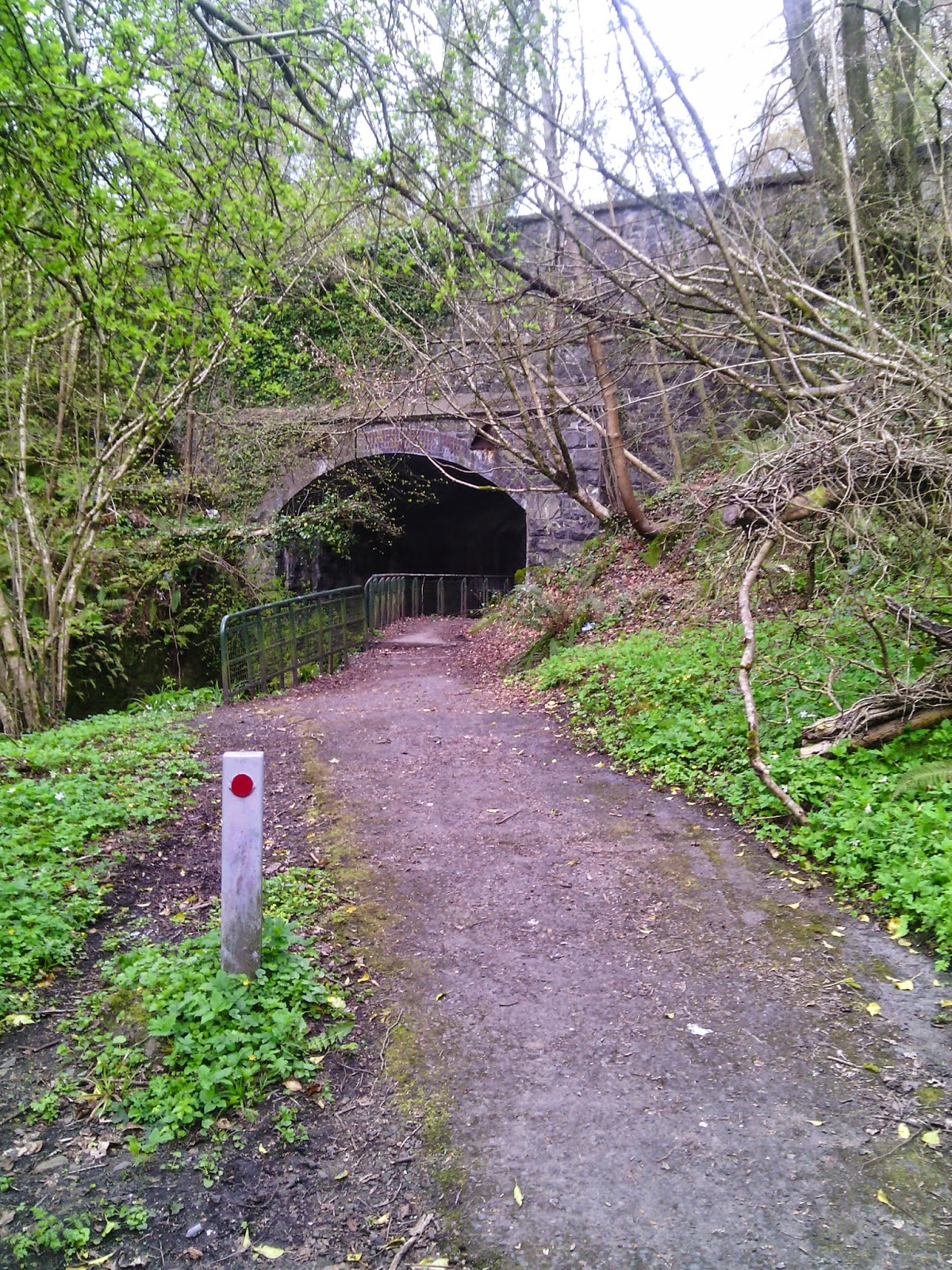
The Bridge at Glen road and the End of the Lower Forest
When you get under the bridge you see a dirt track climbing up to your right. You run to the top of this and you'll be confronted with some serious steps to climb. These steps lead you to the upper forest trails and the start of some fun. If you like muck.

The Steps to the Upper Forest
I always but always take a short rest break when I get to the top of these steps. It's just a wee reward for making it this far and reflect on the times I never made it half as far as this.

Remember to Have a Wee Rest at the Top of the Steps
Once you're done with your rest and you're feeling refreshed it's time to start into the upper forest trails. You'll suddenly notice you're alone. Up here it's just you and the forest and all the creatures in it. Enjoy. So at the top of the steps you take a left, it is the only way you can run. You start to run along, fairly muddy at times, trails. Depending upon whether you are running winter or summer the mud pits vary. But in winter you can expect to be cleaning yourself up in the river afterwards. The mud pits will just eat you up at times...but it is fun. There's no danger. Just go easy and always only concentrate a couple of feet in front of you. You'll be running across some pretty tricky trails at times, which includes lots of tree roots. To your left as you run there is about a 150 feet steep drop into the river. So you'll not want to be falling down there if at all possible.

The Upper Forest Trails

Colinglen Upper Forest

The Steps down the the River Crossing in the Upper Forest
Once you've made it across the river just run up the trails in front of you which lead you further into the forest. You'll eventually see the river reappear on your left and you'll be looking out for mother natures tree arm directing to the right. Just shortly after passing this you'll see 2 trees and a metal pole. That's your right exit out of the forest and into the Glenside nature reserve. The Glenside is a disused quarry and I always treat myself to sitting on the cliff edge and enjoying the view before carrying on.

The Upper Forest Tree Directing you Right

Shortly after you see 2 trees and a metal pole. Take a right out of the Forest
Once you leave the forest you follow a short grass trail along a small stream into Glenside Park. You'll cross a small flat metal walkway and sometimes you may need to go through a bit of water to reach the trails climbing up in front of you towards the top of the old quarry. There are some spectacular views to be had here. Sometimes you'll find the horses running about here and you'll always see plenty of rabbits. One warning is that during summer be careful as it's a place to be bitten by horse flies. Wear plenty of insect repellent. I got a bite last year which grew to the size of a golf ball.
You've now run about 2.2 miles once you leave the forest and Glenside is only a very short trail leading you to the Upper Springfield Road

Enjoying Glenside Park and the view of the old Quarry.
As you come out of Glenside you'll have a short run up the road until you come to the Divis Mountain signpost and Divis Road. You turn right here and climb up Divis Road for about a half a mile until you reach the paths leading to Divis Mountain on the right.

Follow the signpost for Divis and Black Mountain about a half mile up the road from Gelnside
Once you reach the final trails to the mountain you'll see a carpark to your left. Many people come here for walking and normally would park here. When I first started to run the mountain this is where I ran from. It's a 4 mile run from the carpark to Divis Peak and back. So this is a good starting point before trying to run from the bottom forest. To be honest most people who run the mountain run from here. Very few run from the bottom and i've yet to see one other person running the upper forest trails.

Climbing Divis Road, the Carpark to your Left and the Entrance to the Mountain Trails just behind that Van

The Entrance to Divis and Black Mountain trails
Depending upon when you run the upper mountain there'll always be walkers about. People love coming here with there dogs. But you'll come across horses and cows from time to time. Also donkeys kept by the farmers will greet you as you run Divis Road. be careful though, as there's the odd wee dog who'll snap at your ankles....mostly harmless though. A dog barking and wagging it's tail at the same time is not a dog to be feared.
So now all's left to run is the mountain trails. It's 2 miles to the top of Divis Peak from here and then about another mile to climb Black Mountain as well. The first path is great. All tarmac and there's even a slight downhill for about the first 1/4 mile. You run up this path passing a small stone cottage on your right, which is actually a coffee house. Great eh, even a place up here to stop for a coffee but I have yet to have one. They do guides in here as well for all the various trails and routes you can explore up here. The place is full of history dating back thousands of years.

Divis and Black Mountain Trail in Winter
Once past the stone cottage you come to a gate and you pass through this. Immediately to your left you see a dirt trail leading uphill to god knows where. You run that. This is the final trail to climb before you reach the stone path leading to the peak. It's a brave wee run up it an all. Maybe about a mile, maybe slightly less. But it's a fair climb as you're now climbing to the top in ernest. Last time I ran this part a few days ago I was chased by 4 horses. You just never know what you'll meet up here. That's part of the fun and adventure of running it.

The Penultimate Trail and being chased by a few horses
Once you've climbed this trail, and a word of advice, climb this easy otherwise you'll find yourself stopping half way up it, you come to a narrow stone path on your right. This is the final climb to the peak of Divis Mountain. It winds and twists away rightly up to the top and even this last path is pretty tough to run so again go easy. Plus there's a brave few rocks to break your leg on. Gently does it...like a ballet dancer you run your way to the top. The day I took the picture below the people in it were trying to push a childs pram up this path. Not exactly a wise thing to be at. I think they eventually turned back.

The Rocky path to Divis Peak.

The same Path in Winter
When you reach the top, well done. You've climbed about 1600 since you left Colinglen carpark and ran about 5 miles so far. I always place a rock when I get to the top. No reason. Suppose I used to make a wish when I first started running the mountain. These days it's just a habit. There's still quite a bit of running to be done at the stage as well. So don't hang about too long. Enjoy the view and get moving again.

The summit of Divis Mountain
On the summit you will have fantastic views in all directions and a fine view of Belfast Lough and the route the Titanic took before sinking the other side of the Atlantic. Turn around and there's great views of the Mournes. A place I plan to run soon.
So once you reach the summit just keep running straight ahead until you see the path winding you back down again. This is a much better path, tarmac as this is the one generally used by the public. There are great views to be had running down this path. It's pretty steep so best to go easy running down it.

The path leading down from Divis Summit
Once you get to the bottom of this path you'll see Black Mountain in front of you as you run down it. Take a left at the bottom and a short run before taking a right unto a wooden walkway. This brings you to the trails leading up to the summit of Black Mountain. It's a fairly easy climb after what you've just climbed but it's a climb all the same. From the top of Divis Mountain to the top of Blacks Mountain is only just over a miles running, so it's not that far to run and you may as well run it.

The Wooden Walkway Leading to Black Mountain Summit
Once the wooden walkway ends you take a right unto the final trail to the summit. There's a wee bit of a climb here but it's nothing too serious.
So once you get to the top of Black Mountain what next? Back down? Well not exactly. You now run about 2.5 miles of the most wonderful trails through the middle of the mountains. These are the new trails they built, as I used to run this route before the trails were here. However, I used to call this my bog run, as I had to run through 2 miles of bogland towards Blacks Hill. It wasn't easy. But this final 2.5 miles of trails is the icing on the cake for me. It makes the mountain run into pretty much a half marathon endurance test.

The Final 2.5 miles of trails leading away from Black Mountain

The wooden Bridge which leaves about another half mile of this trail before rejoining the main Divis Mt Trail
There's a wee bit of climbing along this trail but not a great deal. You'll eventually come to a small wooden bridge which you cross and this leads you gracefully back unto the main Divis Mountain path where you take a left. You're about 1 mile from the Divis Road Carpark and about another 4 miles to run back down through the Colin Glen Forests, back the way you came. A decent time is suppose about 2hours 20 mins but when I run this route I am not thinking about time...it's building endurance and also to be enjoyed. The views are very fine indeed.

Cleaning up in the River
Once you run back down and you do need a bit of clean up before presenting yourself to the public this is the spot. Just after you come under the bridge again at Glen Rd you'll see this spot above leading down to the river on your right. Park yourself on a rock and start scrubbing. Good luck
No comments:
Post a Comment